
Unified 3D visualization system

Immersive panoramic projection system

Virtual small arms training simulator
Iris-T is a unified 3D visualization system, intended for displaying of 3D virtual scenes, complex articulated 3D models and wide range of special effects. Capabilities of the system allow imaging different natural phenomena and replicating real landscapes.
It is suitable for development of virtual simulators and interactive systems wherein real time 3D visualization is needed. Iris-T could be controlled both by internal commands or control signals from external simulation systems and corresponds to severe requirements of simulation accuracy and image photorealism.
The “Iris-T” is used in interactive systems and training simulators where high-quality real-time visualization is required. “Iris-T” designed in two major versions as a stand-alone fully featured application and as a software development kit (SDK).
Modular structure of the “Iris-T” components
Our system is highly customizable. There is a wide range of ready-to-use components. Structure of modules and resources of the 3D visualization system is emphasized by customer on the stage of the set of supply development from general package of components. Procedure for the set of supply development is following:
selecting auxiliary modules
defining resource libraries structure
new modules development in accordance with customer requirements (optional)
new content creation (optional)
integration with external software (optional)
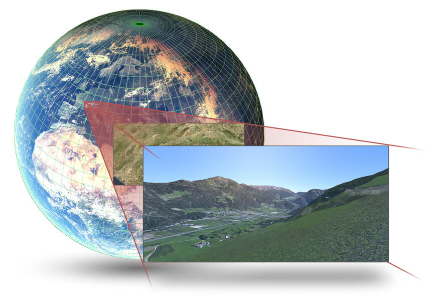
The 3D scenes for the “Iris-T” are generated using real geographical data and contain original information about relief, vegetation and infrastructure objects in accordance with digital maps of terrain data. The sophisticated level of details of the system provides rich set of environment rendering (from blade of grass till whole planet) and smooth transitions from one scale to another. Each level of scalability has its own set of textures of varied sizes which provides balance between visually appealing image and efficiency of visualization.
The key feature for large 3D landscapes generation is the ability to merge 3D scenes composing virtual large-scale areas of thousands square kilometers. Data for 3D scenes are loading dynamically what ensures smooth navigation into joint 3D space without viewable transitions and separate downloads screens.
Precision of Earth model realizes on the low earth orbit level with celestially correct movement and illumination change.
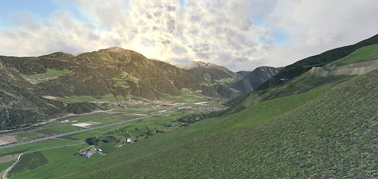
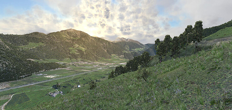
Realism and accuracy of 3D environment rendering in relation to the real conditions are achieved by simulation of whole spectrum of natural phenomena such as:
season and daytime change
different weather conditions
celestial bodies positioning and its movement by lapse of time
illumination change and rigid body physics
ability of custom objects placement
At the same time weather conditions and time of the year could have influence on general level of visibility and illumination. Proper illumination models are calculated even for smallest particles of 3D scenes.
Technologies of after-effects layering are actively employed in 3D visualization. The “Iris-T” also provides such specific capabilities as
simulation of artificial vision
employment of cinematic effects (light flares on lens, ingress of moisture on optical objective)
overpaint masks (blur, haze, thermal wake, water distortions)
Our vegetation objects library consists of scrupulously created 3D models which looks like a real plants There are different sets of resources corresponding to four seasons, each consisting of unique textures and 3D geometry. All types of plants are animated with respect to wind force and direction.
Scene generation takes into account natural formation processes. The growth of plants is regulated according to the initial geographical data used by the scene generator. The variety of plant families within regions is preserved at a high level. Different vegetation regions are smoothly interpolated on the borders.
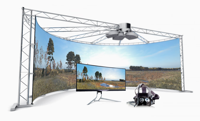
Our technology helps to create large, truly high resolution video presentations running on distributed systems build from a wide set of hardware. There are two major modes of operation: video streaming and distributed 3D scene rendering. These two modes can be combined to provide even more flexible solutions. The video streaming functionality is implemented using open standards. Any device with support for the corresponding video streaming protocols could be used to receive and display this data. Our implementation doesn’t require any third party application to be used. The input data is fed to the system in real-time directly from a video memory.
The distributed 3D scene rendering provides a range of post-processing tools for video mapping. All of the participating hosts are constantly synced in a wide specter of parameters, such as simulation time, frame-rate, environmental conditions and etc. Every host is responsible for a small sub area (channel) of the final image and could stream video or be connected right to the video projector.

Execution of the simulation modeling tasks is performed via usage of specific scenarios pre-created by combat warfare environment simulation tools. Functions of the scenarios include:
computation and simulation of spatial motion
ballistic equations
objects status control
simulation time management (change of seasons, day time and so on),
weather condition changes
playing effects
Simulation modeling used in the fields related with planning ,analysis, risks for the health and equipment including separate areas of business, science and governmental activity.
Tools of combat warfare environment simulation operates in pair of with 3D visualization system “Iris-T” only.
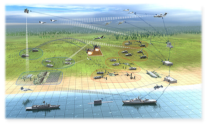

The 3D visualization system “Iris-T” operates with resources which stored in the libraries. Its content forms at the stage of the supply development.
3D models library contains such objects as :
vegetation
samples of weapon and military equipment (air, sea and ground)
urban infrastructure, industry objects and municipal buildings
civilians and military men
sfx
For library enrichment it is possible to organize customized development of additional 3D models.

The API of “Iris-T” graphic core represents detailed set of functions providing capabilities to develop specific software products with 3D graphic support.
These functions control mathematic calculations, handling file system and network routines as well as provide 3D visualization and asset resource control including physical properties, sound and animation playback and so on. Positioning of static and moving objects emphasized in proper geographic and geocentric coordinates on Earth ellipsoid.
The “Iris-T” graphics core specialized on simulation modelling support as key feature of virtual simulators and interactive systems.
Our software provides support for OpenGL v.4.0 standard and GLSL shader language.


Remote control API includes great number of templates for integrating our product into third-party applications. Using of templates accelerates development process and minimizes human factor influence on the final product as well as optimizes time and resources.
Under realization of remote control the 3D visualizer could be considered as «black box» receiving input data and providing requiring feedback by TCP/IP protocol.
The «black box» principal ensures capabilities of custom software products development without deepening into the “Iris-T” program code including service of visualization process, mathematic calculations and so on.
Interaction of exterior external data sources with 3D visualization system “Iris-T” is performed through special data exchange gateway. The gateway source codes allow to ensure correct and effective interaction and contains information of the “Iris-T” requirements to input data.


The 3D scenes for “Iris-T” visualization system are automatically generated from varied input data such as:
digital maps as in commonly used formats as in formats employed in the MOD of Russian Federation
aerial images
satellite images
heights matrices
For practical employment of this data we provide a set of additional tools for viewing and editing generator’s input data:
digital maps formnat converting
landscape, infrastructure and objects data obtaining
digital maps creation and modification
The resultant scenes have double-precision geocentric coordinates and preserve initial input data. Scenes can be seamlessly combined to form single one.


The editor is a light-weight 3D model adjustment tool for further usage in the “Iris-T” visualization system. Conversions of models from common formats are performed by special exporter which included into editor set. Main editor functions are :
customization of converted models inside visualizer
level of detail variation in accordance with distance from the object
material and sfx handling
physical bodies, collisions and joints assignment
sound effects association with object
objects hierarchy formation
changing of object’s physical features (levels of firmness, fluctuation and so on)
Animation graph editor is an additional tool which allows editing animation tracks. Main graph editor functions are:
automatic development of new animations by blending existing ones according to the special rules
creation and visual editing of animation graph
smoothing of transitions between animations
animations export and import
loading of models with skeletal animations

 Sales & Support (rus)


